
Hi, here you can download APK file "com.vaiable.android.michinoeki" for free, apk file version is 1.1.3 to download to your android just click this button. It's easy and warranty. We provide only original apk files
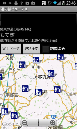
It is an application to display the road stations nationwide on the map.
As of May 25, 2014, 1030 stations are recorded.
If you downloaded before 05/25, please get it again from the menu.
[Method of operation]
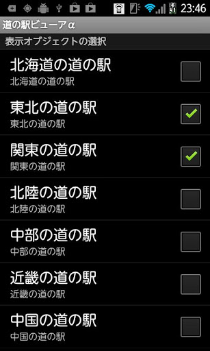
· By opening "Setting display object" from the menu, you can switch "show / hide" of the road station for each district.
· Select the station marker on the road on the map, the following operation is possible.
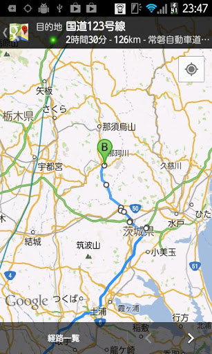
Click the label of "Michi no station name" ==> Display selected station in the center of the map "Long street name" label long click ==> Pass selected station name to other application Click "Web page" button ==> Select station Show official page Long click on "Web page" button ==> Search selected station on google Click "Route search" button ==> Search from the current location Select route "Visited" check ON ==> Change marker color of selected station
* It takes time to start up after downloading or downloading the data the first time after upgrading. please note that.
* We are making efforts to keep the data current and accurate, but please do so at your own risk in actual use.


